Cavalry fort and vicus
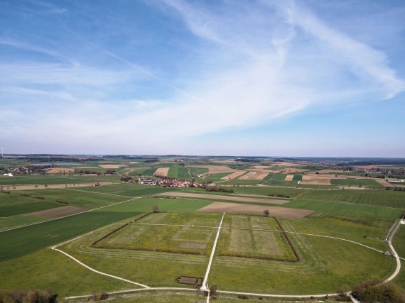
The archaeological park and the LIMESEUM are based on the fort that the Romans built around 1900 years ago near the present-day village of Ruffenhofen. As a result, the monument, which also includes parts of the civil settlement belonging to the camp, has been preserved in the ground. Aerial photographs and, above all, geophysical prospecting prove the preservation of this monument. The Römerpark and the LIMESEUM have made their protection and mediation their task.
Unfortunately, the ancient name is not (yet) known, but there are indications that around the middle of the 2nd century AD. the cohors VIIII Batavorum was stationed here.
Research and Development
 Reiterkastell
The Ruffenhofen fort is located on the so-called route 13 of the Upper German-Raetian Limes. This route division is based on the research of the Reichslimeskommission, which has been investigating the entire course of the Limes since 1892. At that time, smaller excavations were also carried out in the Ruffenhofen fort area.
After the work of the Imperial Limes Commission, the Limes was first comprehensively measured and documented in the area around the year 2000. Since the summer of 2003, the Deutsche Limeskommission has been taking care of the preservation, scientific research and processing as well as the tourist development of the monument.
The development of the Roman Park Ruffenhofen is also related to this. This includes the exploration of the archaeological monument through geophysical prospection, as well as the sustainable visualization of the archaeological structures.
On July 15, 2005, the Limes was added to the UNESCO World Heritage List. In 2012 the LIMESEUM opened as the first new museum building in Bavaria since the Upper Germanic-Raetian Limes was declared a World Heritage Site.
Fort
In Roman times, forts were built along the Upper German-Raetian Limes to allow troops to control the frontier. This part of the Limes has now been recognized as a World Heritage site.
Every fort included administrative as well as storage buildings, barracks for the soldiers, stables, and the commander's house. Civilian settlements (vici) sprung up close to the forts.
The grounds of the Ruffenhofen fort have not been built on since antiquity. As a result, the foundations of the archaeological structures have been preserved underground - in contrast to the situation of many other Limes forts. With an interior area of c. 3.7 hectares, the fort in Ruffenhofen is the largest fort between the military bases of Aalen and Weißenburg. Originally made with wood, the fort was modernized as a stone construction in 150/160 AD.
Visualization
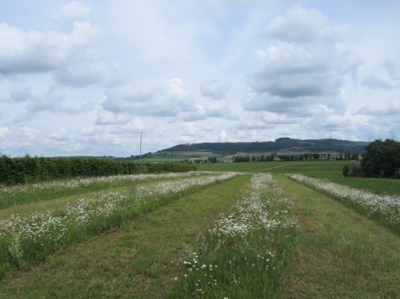 Reiterkastell Bepflanzung der Gräben
Ruffenhofen Roman Park has deliberately chosen to do without elaborate reconstructions of the archaeological features at the site. Instead, plants play the role of buildings, creating a visual impression of the antique constructions. A hornbeam hedge represents the fort wall, and white-blossoming plants shape the fort ditches.
Vicus
Tradesmen as well as craftsmen followed the military to the Limes and established civilian settlements, the so-called vici. As the soldiers in the forts only received very basic rations and services, there was a constant need for a variety of goods and foods.
Long dwellings, co-called Streifenhäuser, with shops, taverns, and workshops were built along the streets. Nearby, there were public buildings, for example temples, baths, and inns. Cemeteries were established at the outskirts of the villages, along the through roads.
The Ruffenhofen vicus has not yet been researched in detail and we do not have precise dates about the settlement's history. Our knowledge about the vicus comes primarily from aerial archaeology and geophysical prospection. In the Roman Park, the presence of a temple and a large building have been marked by plants. A large storage building is visualized with sand and slices of tree trunks.
cemetery
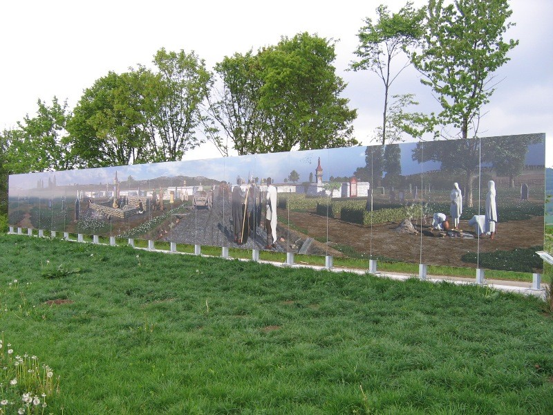
Cemeteries or grave fields were usually located outside the civil settlements along the arterial roads.
At the cemetery in the east, there is a large information board illustrating the routine in a cemetery.
 Gräberfeld 3D